News Summary
Jacksonville is facing an active weather pattern on July 15, 2025, with showers and thunderstorms expected throughout the day. High temperatures are projected around 90°F, with humidity making it feel hotter. The National Weather Service warns of strong storm risks including heavy rainfall, gusty winds, and lightning, potentially leading to localized flash flooding. Residents are advised to stay informed and take necessary precautions as weather conditions evolve in the following days.
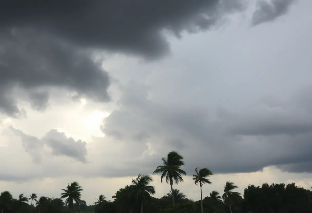
Jacksonville is preparing for an active weather pattern as the forecast for July 15, 2025, calls for the possibility of showers and thunderstorms throughout the day. The expected high temperature will reach approximately 90°F, contributing to a humid atmosphere that could make conditions feel as hot as 101°F during the afternoon.
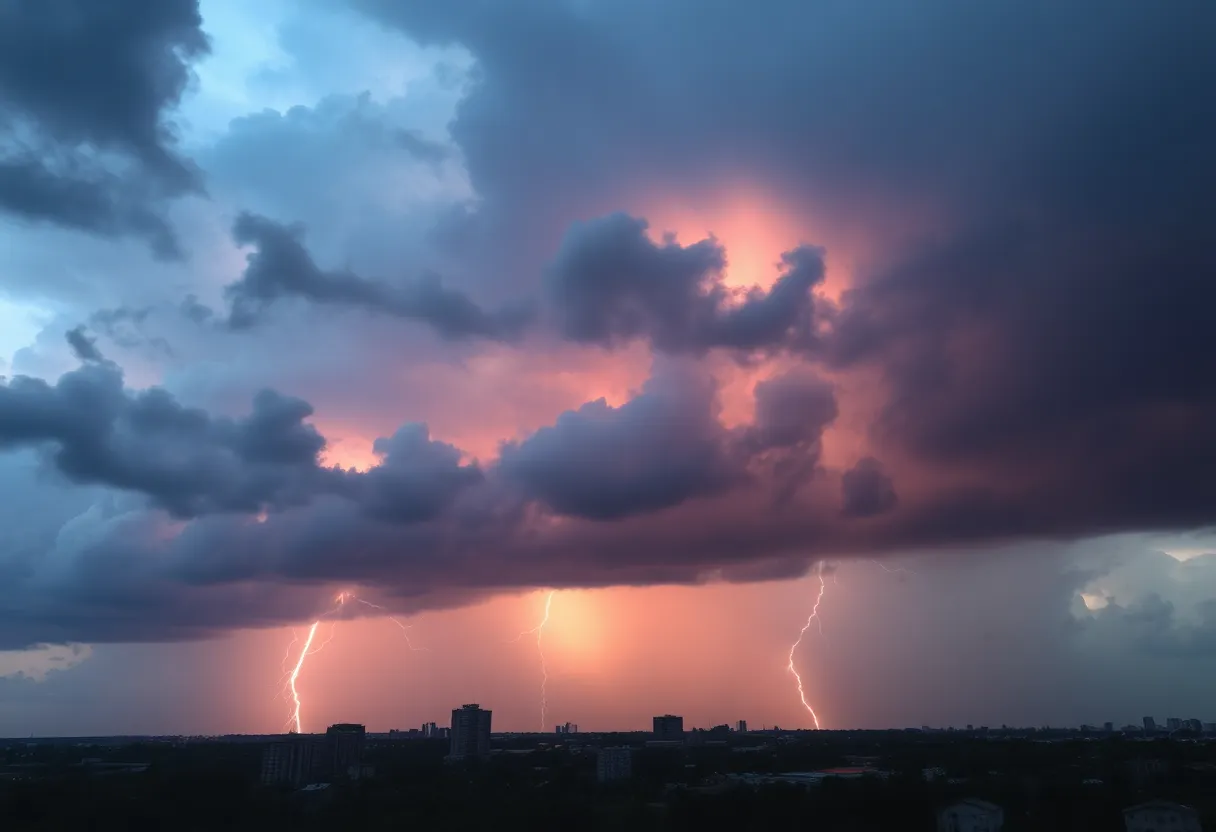
Residents can anticipate partly cloudy skies today, with a 40% chance of showers and thunderstorms beginning mainly after noon. The National Weather Service has warned that strong storm risks could include robust winds, frequent lightning, and heavy rainfall, particularly between 4 p.m. and 9 p.m. If severe weather arises, localized flash flooding is a concern due to heavy rainfall, with some areas along the Florida Peninsula potentially receiving over 4 inches by Tuesday night.
As evening approaches, the likelihood of rain will decrease to about 20% before 11 p.m., with temperatures dropping to a low of around 75°F. Tonight’s weather is expected to remain partly cloudy with an isolated shower possible.
In the coming days, the weather in Jacksonville will continue with similar patterns. Wednesday’s forecast indicates partly cloudy skies with temperatures ranging from 74°F to 92°F, along with the potential for a few inland storms. Thursday’s weather is predicted to be partly sunny, similarly yielding a high of 73°F to 92°F and a few inland storms. The temperatures are expected to climb further on Friday, reaching highs of 74°F to 95°F, marking it notably hot with chances for additional storms.
Saturday’s conditions are expected to be partly sunny with a high of 74°F to 96°F and some storms persisting into Sunday. Residents should remain vigilant as isolated afternoon storms may occur again, with Sunday temperatures also anticipated between 75°F and 95°F. Look for continued warm weather into Monday, exhibiting partly sunny skies with a potential high of 74°F to 94°F.
Meanwhile, the National Hurricane Center has issued observations regarding a potential tropical depression forming in the northern Gulf of Mexico. Currently identified as Invest 93L, this system has a 40% chance of development over the next 48 hours. If significant development occurs, forecasts indicate a possibility of the storm making landfall in southeastern Louisiana by Thursday morning, July 17. Regardless of the tropical system’s development, portions of Florida may experience heavy rainfall that could elevate the risk of localized flash flooding.
Current conditions include a steady breeze from the northeast at speeds ranging from 11 to 15 mph, with gusts up to 20 mph expected at times. The ongoing storm activity has garnered attention, with over 25,000 lightning strikes recorded in Florida over a 24-hour period from Sunday to Monday, underscoring the severity of the weather system in the region.
Additionally, beachgoers are advised to remain cautious as rough surf and strong rip currents are anticipated at Florida beaches until Wednesday. The situation remains dynamic, and the forecast reflects a sustained threat of tropical downpours and high temperatures extending throughout the week.
Residents are urged to stay informed on evolving weather conditions and to take necessary precautions to ensure safety during this active weather period.
Deeper Dive: News & Info About This Topic
HERE Resources
Tropical Development Potential Looms Over Florida
Power Restored to Jacksonville Customers After Outage
CW Theater to Close Its Doors in West Melbourne
Jacksonville Players Win Big in Florida Lottery Fantasy 5
Back to School Events in Jacksonville Gear Up Families
Wildfires in Canada Impact U.S. Air Quality
Archdiocese of Miami Opposes Controversial Migrant Detention Facility
White Sage Fire Forces Evacuations Near Grand Canyon
Kerr County Faces Backlash Over Emergency Alert Failures
Jacksonville Prepares for Intense Hurricane Season
Additional Resources
- Jacksonville Weather News
- Wikipedia: Weather in Florida
- News4JAX Weather Update
- Google Search: Jacksonville Weather Forecast
- The Weather Channel
- Encyclopedia Britannica: Weather
- USA Today Weather Report
- Google News: Jacksonville Storms

Author: STAFF HERE JACKSONVILLE WRITER
The JACKSONVILLE STAFF WRITER represents the experienced team at HEREJacksonville.com, your go-to source for actionable local news and information in Jacksonville, Duval County, and beyond. Specializing in "news you can use," we cover essential topics like product reviews for personal and business needs, local business directories, politics, real estate trends, neighborhood insights, and state news affecting the area—with deep expertise drawn from years of dedicated reporting and strong community input, including local press releases and business updates. We deliver top reporting on high-value events such as the Jacksonville Jazz Festival, Riverside Arts Market, and World of Nations Celebration. Our coverage extends to key organizations like the Jacksonville Chamber of Commerce and JAXUSA Partnership, plus leading businesses in logistics, healthcare, and entertainment that power the local economy such as CSX Corporation, Baptist Health, and VyStar Credit Union. As part of the broader HERE network, including HEREOrlando.com, HEREStPetersburg.com, HERETallahassee.com, and HERETampa.com, we provide comprehensive, credible insights into Florida's dynamic landscape.