
News Summary
Hurricane Erin is currently situated off the east coast, set to affect First Coast beaches, bringing hazardous surf conditions and a high risk of rip currents. High surf warnings indicate wave heights could exceed 9 feet by Wednesday. Meanwhile, lifeguards caution beachgoers to avoid swimming as conditions worsen. Authorities are also monitoring for another potential tropical system forming nearby, which could impact surf levels further. Beach safety remains a priority as Jacksonville Beach Ocean Rescue raises red flags along the shoreline.
Jacksonville, Florida: Hurricane Erin to Bring Hazardous Surf Conditions and High Rip Current Risk to Florida Beaches
Hurricane Erin is currently positioned off the east coast and is expected to impact First Coast beaches starting Monday, August 18, 2025. Beachgoers are urged to exercise caution, as high surf warnings have already been issued, indicating possible breakers exceeding 7 feet from Tuesday through Thursday. Alongside the high surf, the risk of rip currents is classified as high and will persist through Thursday, August 21, posing significant hazards to swimmers.
The first signs of Hurricane Erin’s swell are anticipated to arrive Tuesday morning. Initial wave heights are expected to be relatively small, around waist-high, but these conditions are projected to change rapidly throughout the day. By Wednesday, surf heights are forecasted to peak at 9-10 feet around midday as Erin continues its track offshore. The direction of the swell will initially come from nearly due east, shifting to an east-northeast direction by Thursday.
Accompanying the large surf, northeast winds of 12-15 mph with gusts up to 18-20 knots will contribute to choppy conditions. This is especially concerning for popular surf locations like North Jetty, which are typically reliable. However, conditions may improve on Thursday with lighter offshore northwesterly winds, providing better surfing opportunities.
The swell’s long periods, with intervals ranging from 15 to 16 seconds, will lead to well-overhead sets and numerous closeouts at various breaks, making for challenging and unpredictable surfing conditions. Meanwhile, meteorologists are monitoring the situation for another tropical system that may form southeast of the Bahamas early next week, which could track a similar path to Hurricane Erin, potentially increasing the surf even further.
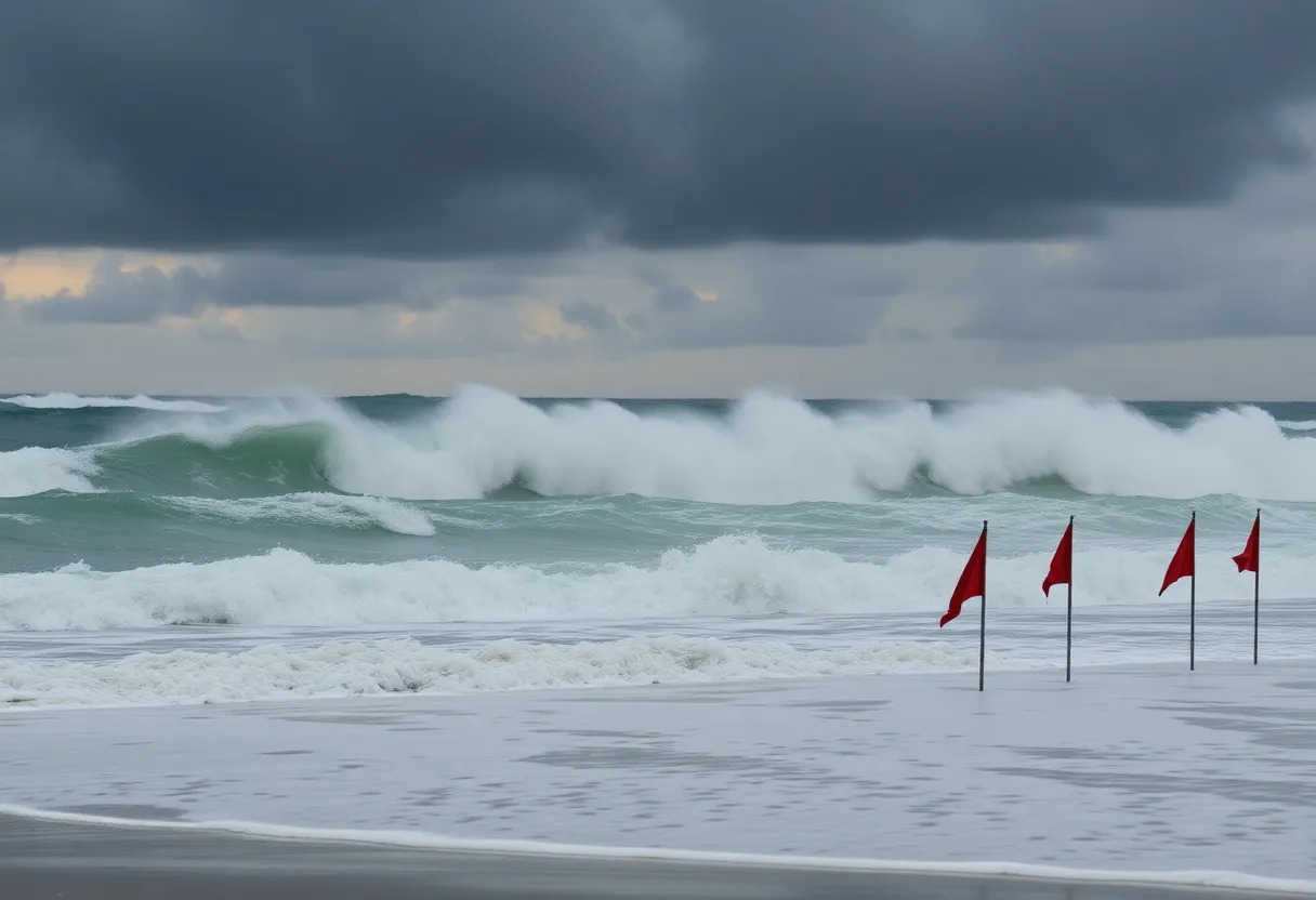
As a precautionary measure, Jacksonville Beach Ocean Rescue has raised red flags along the beach, indicating heightened surf conditions and potential swimming risks. Lifeguards are staying vigilant throughout the week for emergencies associated with the deteriorating conditions, particularly with increased tidal heights and surf.
In addition to the expected surf and rip currents, moderate beach erosion and minor tidal flooding are predicted due to the high surf and swells impacting local beaches. Residents and visitors are encouraged to heed posted warning flags and signs and avoid entering the water under these hazardous conditions. The National Weather Service has reiterated that rip currents can sweep away even the strongest swimmers and has advised against swimming during these times.
In response to potential coastal hazards in neighboring areas, evacuations and a state of emergency have been issued for some communities in North Carolina’s Outer Banks due to expected tidal flooding. As Hurricane Erin’s effects progress over the week, beach safety will remain a top priority as authorities monitor the situation closely.
Surfers are preparing for the upcoming conditions, anticipating enjoyable waves but also recognizing the associated risks that come with powerful swells. Safety remains paramount as the community braces for the impacts of Hurricane Erin, urging all beachgoers to prioritize their well-being amidst the excitement for surf.
Deeper Dive: News & Info About This Topic
HERE Resources
Hurricane Erin Triggers Tropical Storm Watch in Outer Banks
Hurricane Erin Gathers Force: Impact Expected Along East Coast
Jacksonville Faces Heat and Tropical Storm Effects
Hurricane Erin Raises Concerns at Jacksonville Beach
Jacksonville Steps Up Traffic Enforcement Amid Fatalities
Jacksonville Weather Impact Alert Issued Amid Hurricane Erin
Hurricane Milton Approaches Florida: Red Cross Preparedness Efforts
Jacksonville Activates Cooling Centers Amid Heat Advisory
Jacksonville Schools Navigate Property Tax Changes
Florida Faces Increased Hurricane Risk Amid Marine Heat Wave
Additional Resources
- First Coast News: Jacksonville Beach Conditions Hurricane Erin
- Wikipedia: Hurricane Erin
- News 4 JAX: Waves for Days Hurricane Erin
- TCPalm: Hurricane Erin Dangerous Wave Heights
- News 4 JAX: Major Hurricane Erin Update

Author: STAFF HERE JACKSONVILLE WRITER
The JACKSONVILLE STAFF WRITER represents the experienced team at HEREJacksonville.com, your go-to source for actionable local news and information in Jacksonville, Duval County, and beyond. Specializing in "news you can use," we cover essential topics like product reviews for personal and business needs, local business directories, politics, real estate trends, neighborhood insights, and state news affecting the area—with deep expertise drawn from years of dedicated reporting and strong community input, including local press releases and business updates. We deliver top reporting on high-value events such as the Jacksonville Jazz Festival, Riverside Arts Market, and World of Nations Celebration. Our coverage extends to key organizations like the Jacksonville Chamber of Commerce and JAXUSA Partnership, plus leading businesses in logistics, healthcare, and entertainment that power the local economy such as CSX Corporation, Baptist Health, and VyStar Credit Union. As part of the broader HERE network, including HEREOrlando.com, HEREStPetersburg.com, HERETallahassee.com, and HERETampa.com, we provide comprehensive, credible insights into Florida's dynamic landscape.