
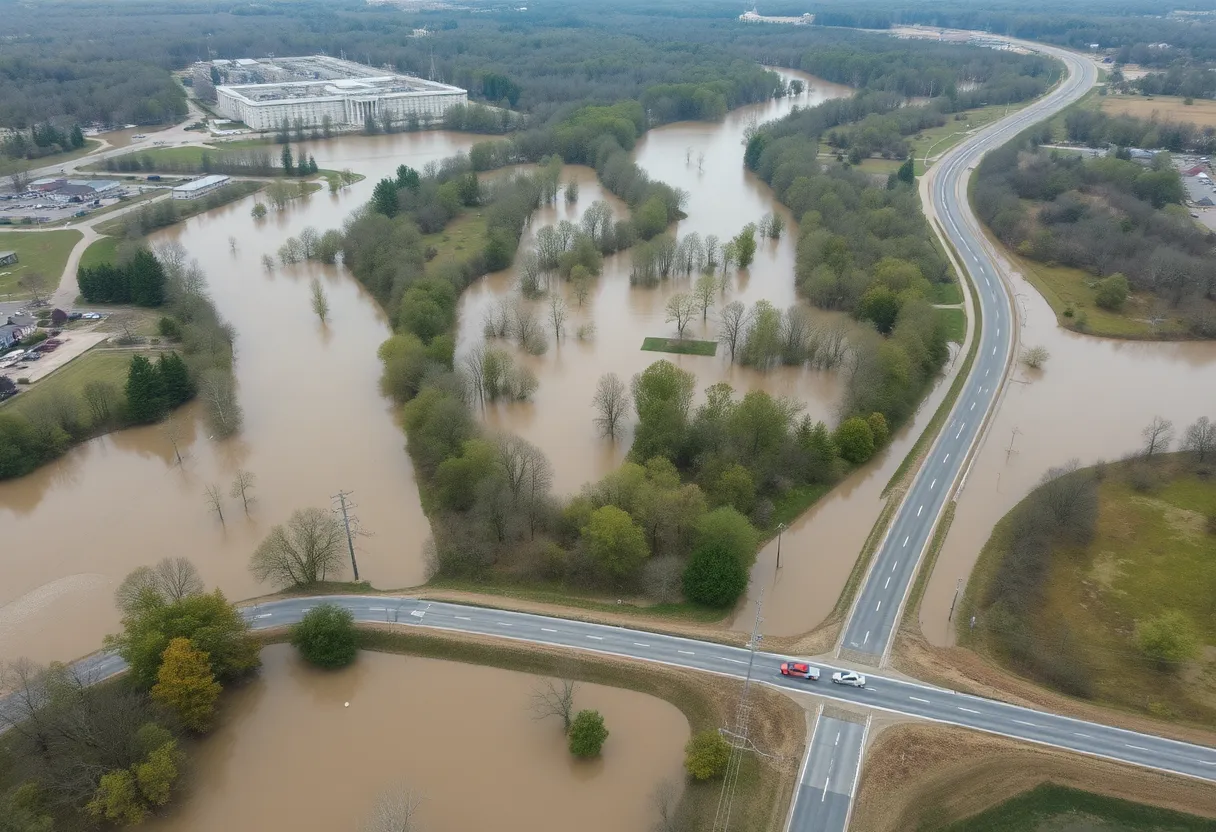
Flooded Areas in South Central Kentucky
South Central Kentucky is facing severe flooding due to heavy rainfall, prompting emergency declarations and road closures in affected counties. Officials are advising residents to stay off the roads, sign up for alerts, and report storm damage to ensure community safety. With river levels rising and more rain in the forecast, local authorities are on high alert to manage the ongoing situation and keep the public informed about potential dangers.
In a challenging situation for many residents, multiple counties in South Central Kentucky are grappling with significant flooding conditions due to the heavy rainfall hitting the area. As the water levels continue to rise, officials are working diligently to keep the community safe and informed.
Recently, Adair County’s KYTC (Kentucky Transportation Cabinet) released a road closure report around 9:15 p.m., alerting drivers to the hazardous conditions. It’s important to stay off the roads if you can—safety first! Additionally, Wayne County Judge Executive Scott Gehring has declared a state of emergency in response to the flooding risks. Residents in Wayne County are being particularly cautious and are advised to stay away from areas including Duncan, Sandy, Beech Valley, and Highway 92 near Dollar General. Reports have been coming in about significant flooding along Michigan Avenue and Ranklin Lane.
Meanwhile, in Pulaski County, officials are encouraging everyone to sign up for CodeRED alerts via their mobile app to stay updated on any emergency situations. The Pulaski County Office of Emergency Management has also put out a request for residents to report storm damage through their website. This proactive approach is helping to keep everyone informed and safe as the situation evolves.
The Jackson County Sheriff’s Office is monitoring the situation closely, having emergency plans in place just in case things take a turn for the worse. The Jackson County Fiscal Court is prepared with emergency shelters and is updating information on social media to keep the community in the loop. Unfortunately, several locations in Jackson County are currently underwater, further stressing the need for vigilance.
According to meteorologist Ben Beddoes, water levels in the Red River in Powell County are rapidly rising, with expectations for the river to crest by Sunday evening. Highways 613 and 2026 in Powell County are also closed due to flooding. The Powell County Emergency Management team is making ongoing checks in areas that are prone to flash flooding, striving to ensure the safety of all residents.
Flood warnings have been issued for parts of northeast Kentucky, including Boyd, Carter, and Greenup Counties, expiring at 3:00 AM EST on Sunday. Recently, up to 1 inch of rain has fallen in northeast Kentucky, with further rainfall between 1 to 2 inches anticipated. Areas like Ashland, Ironton, and Grayson will feel the impacts.
In addition, urban area and small stream flooding are ongoing across east central, northeast, south central, and southeast Kentucky. Flash flood warnings are currently in effect for several counties, including Southern Christian, Todd, and southeastern Trigg, lasting until 12 PM CST. Residents can expect an additional 1 to 2 inches of rain, which is likely to worsen existing flooding conditions.
Here’s something to keep in mind: the National Weather Service has issued warnings about life-threatening flash flooding and severe thunderstorms across the region. A substantial accumulation of 2 to 6 inches of rain is forecasted over the weekend, while isolated areas might receive even more precipitation. It’s crucial for residents to remain cautious and stay informed about local flood conditions and emergency alerts.
As the rain continues to pour and the rivers swell, communities are banding together, staying informed, and looking out for their neighbors. By keeping abreast of all the updates and heeding advisories, residents can better protect themselves and their loved ones. Let’s hope for calmer skies ahead!
News Summary Aegis Gibson LLC has revised its home construction plans in St. Johns County,…
News Summary Jacksonville is welcoming community involvement with its JAXBest 2025 initiative, inviting residents to…
News Summary Danone U.S. has opened a new $65 million production line in Jacksonville, Florida,…
News Summary Dennis Gray Jr., 24, was arrested for armed robbery after returning to Burger…
News Summary Boeing has delivered the first upgraded Increment 3 Block 2 P-8A aircraft to…
News Summary Jacksonville is set to commemorate Juneteenth, a federal holiday recognizing the emancipation of…