News Summary
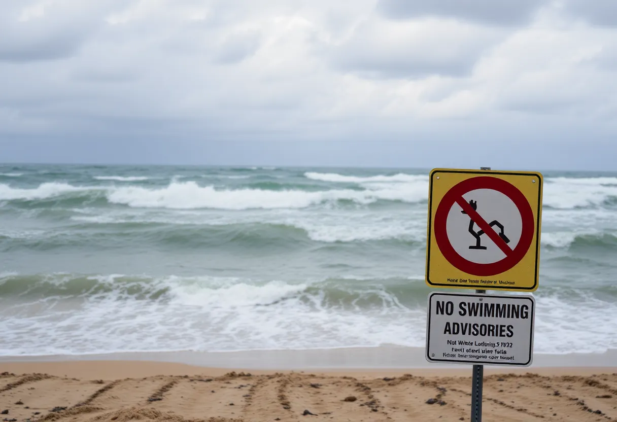
A Weather Impact Alert has been declared for Jacksonville, Florida, due to Hurricane Erin, resulting in dangerous beach conditions from August 18 to August 20. High rip currents and potential swells exceeding 7 feet are expected, urging beachgoers to avoid swimming. The hurricane has intensified to 75 mph winds, projected to maintain offshore. Residents should be cautious of minor flooding and beach erosion during high tide, while a heat advisory warns of high temperatures leading up to the storm. Precipitation may occur on Monday afternoon, but the week will yield lower wave heights and better beach conditions this weekend.
Jacksonville Weather Impact Alert Issued Amid Hurricane Erin
A Weather Impact Alert has been issued for Jacksonville, Florida, indicating dangerous beach conditions from Monday, August 18 through Wednesday, August 20 due to Hurricane Erin, which will pass approximately 700 miles off the east coast of Florida. The upcoming days are forecasted to bring a high risk of rip currents, with potential swells exceeding 7 feet, leading to perilous surf situations along local beaches.
As Hurricane Erin progresses, beachgoers are warned to avoid swimming in the ocean during this period. The National Hurricane Center has reported that Erin has intensified to hurricane status, featuring maximum sustained winds of 75 mph. While the storm is expected to maintain its strength and could reach winds of 115 mph, it is likely to remain well offshore without significant wind or rain affecting Jacksonville and surrounding areas.
In addition to the surf hazards, minor flooding risks are anticipated during high tide, particularly impacting regions near the St. Johns River, Intracoastal Waterway, and local inlets. As Hurricane Erin approaches, onlookers can also expect beach erosion as a consequence of high swells and storm activity.
Weather Conditions Leading Up to the Alert
In the days leading up to the Weather Impact Alert, conditions in Jacksonville are expected to remain mainly dry, with temperatures reaching the mid-90s. However, a heat advisory has been announced, indicating that heat indices could create “feels like” temperatures of 108 to 110 degrees. This advisory will be in effect from 11 a.m. to 7 p.m. on Monday, emphasizing the need for residents to stay hydrated and avoid outdoor exertion during peak heat hours.
Additionally, pop-up thunderstorms are likely to develop on Monday afternoon, primarily between 4 p.m. and 7 p.m.. Although these storms could create conditions that lead to localized rainfall, areas along the coast, particularly from Jacksonville Beach southward, should remain mostly dry during this time.
Future Forecast and Weekend Conditions
Looking ahead to the upcoming weekend, Jacksonville residents can expect more favorable beach conditions with lower wave heights of around 1 to 2 feet and a slight chance for scattered storms inland. However, as Hurricane Erin continues its trajectory, larger swells and hazardous beach conditions will be expected as the storm approaches.
Weather experts have highlighted that with the passage of Hurricane Erin, particularly on Wednesday and Thursday, an increase in surf height and more hazardous conditions will directly impact local beaches. Residents are strongly advised to heed warnings and exercise caution during this potentially dangerous weather event.
As weather patterns begin to shift in response to the advancing hurricane, those living in or visiting Jacksonville should stay informed of changing conditions and follow safety advisories regarding ocean and beach activities. With an alert in place and adverse weather expected, caution and preparedness will be key in navigating the coming days as the situation unfolds.
Deeper Dive: News & Info About This Topic
HERE Resources
Hurricane Milton Approaches Florida: Red Cross Preparedness Efforts
Jacksonville Activates Cooling Centers Amid Heat Advisory
Farmers’ Almanac Predicts Harsh Winter Ahead
Jacksonville’s Top Private Schools Recognized in New Rankings
Temporary Barriers Successfully Prevent Flooding Damage in Juneau
Controversial Traffic Stop in Jacksonville Sparks Outrage
Flood Barriers Save Juneau from Record-Breaking Glacial Outburst Floods
2025 Careathon Auction Launches in Jacksonville, Florida
Tragic Motorcycle Accident Claims the Life of Local Father
Jacksonville’s Private K-12 Schools See Rising Rankings
Additional Resources
- News4Jax: Jacksonville Faces Scattered Storms and Rising Heat
- Wikipedia: Tropical Storm
- Action News Jax: First Alert Weather for Jacksonville Area
- Google Search: Jacksonville Weather
- First Coast News: Jacksonville Weather Impact Alert
- Google Scholar: Jacksonville Hurricane Erin
- Jacksonville.com: Heat Advisory Issued
- Encyclopedia Britannica: Hurricane Erin
- Hoodline: Jacksonville Weather Warning
- Google News: Jacksonville Hurricane News

Author: STAFF HERE JACKSONVILLE WRITER
The JACKSONVILLE STAFF WRITER represents the experienced team at HEREJacksonville.com, your go-to source for actionable local news and information in Jacksonville, Duval County, and beyond. Specializing in "news you can use," we cover essential topics like product reviews for personal and business needs, local business directories, politics, real estate trends, neighborhood insights, and state news affecting the area—with deep expertise drawn from years of dedicated reporting and strong community input, including local press releases and business updates. We deliver top reporting on high-value events such as the Jacksonville Jazz Festival, Riverside Arts Market, and World of Nations Celebration. Our coverage extends to key organizations like the Jacksonville Chamber of Commerce and JAXUSA Partnership, plus leading businesses in logistics, healthcare, and entertainment that power the local economy such as CSX Corporation, Baptist Health, and VyStar Credit Union. As part of the broader HERE network, including HEREOrlando.com, HEREStPetersburg.com, HERETallahassee.com, and HERETampa.com, we provide comprehensive, credible insights into Florida's dynamic landscape.